 The
Lincoln Highway
The
Lincoln Highway 
and Shady Oaks
 The
Lincoln Highway
The
Lincoln Highway
and Shady Oaks
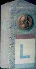
Original Lincoln Highway Marker
Click here to find links to other Lincoln Highway Sites
The Twentieth Century arrived to the Rock Valley area and a whole new era began. The area became the focal point to a new generation of pioneers. These trendsetters abandoned the name Rock Valley and put the name Shady Oaks on the map. Shady Oaks was destined to become synonymous with transcontinental travel and the Lincoln Highway.
In 1912, representatives of the auto makers and cement companies met in Detroit, Michigan, to address a problem that behooved the automotive industry. The shortage of good roads was detrimental to sales. Carl Graham Fisher's plan for a graveled highway across the United States, at an estimated cost of $10 million, was enthusiastically received by these leaders. Thus, the Lincoln Highway Association was incorporated.
This dream was not for an all new road. It would be a ribbon of many existing roads linked together which would eventually fuse agriculture and industry. The highway was to be recognized in memory of Abraham Lincoln. As it unfurled across the United States, folks everywhere adopted the slogan, "See America first!"
According to the "Official Road Guide to the Lincoln Highway" published in 1916, Marshalltown was 1,207 miles from New York and 2,124 miles from San Francisco. The Highway benefited Marshalltown with additional trade and publicity, but the County generated little effort to improve the road that divided it. During wet weather, roads out of Marshalltown were mud-choked in every direction leaving farms isolated and cutting school attendance.
Travel was difficult and long. There were few, if any, supportive facilities for travelers. Most had to stay at a cramped and hot hotels in the cities or pitch a tent, often attached to their vehicle, at a hospitable spot along the road. Shady Oaks was one of those favorite spots. Because the road did not generally go in a straight line between two points, it would often take many days to travel what would now take just a matter of hours.
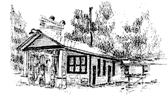
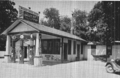
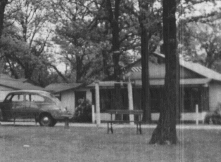
Shady Oaks Gas Station and Eatery
(Click on the text to see an actual photo)
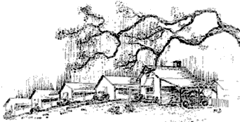
The road past Shady Oaks was already established as a farm-to-market route that had naturally developed during the settlement of Marshall County. In 1913, the road was designated as part of the Lincoln Highway/U.S. 30. The habit of pitching tents and picnicking at the inviting location of the abandoned Rock Valley School led to the development of the first campground and cabin camp West of the Mississippi River for transcontinental travelers. It was in this era that the core of Rock Valley was named Shady Oaks, thus putting it forever on the map.
Les Norton --- Bill Norton
In order to expand from their already popular gas station and eatery, the Norton brothers realized the need for overnight accommodations. Brothers, Leslie R. Norton and William A. Norton, selectively restored Shady Oaks into a park-like setting for camping before beginning their work on the cabin camp. They graveled the path that once led to the Rock Valley School, put in sidewalks, planted flowers and shrubbery, installed their own electrical and telephone systems, dug a new well, buried plumbing, built fireplaces, placed lawn furniture, provided recreational facilities such as horseshoe courts, and constructed all of the buildings necessary for the operation of the cabin camp.
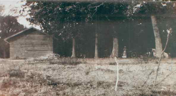
Log Cabin Dayroom and Showerhouse During Lincoln Highway Era
Log Cabin Dayroom and Showerhouse Today
(Click on the text to see actual photos)
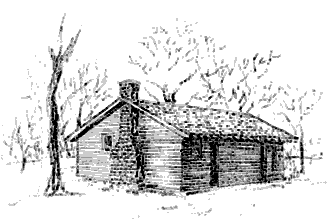
In 1924, a log style building was constructed for picnickers and utilized as a dayroom for tent campers. It was soon converted into a showerhouse/laundry and the the original lodge became the office.

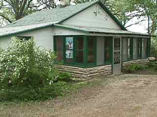
Original Lodge and Office During the Lincoln Highway Era
Original Lodge and Office Today
(Click on the text to see an actual photo)
Local social clubs also used the buildings for their picnics and
meetings. A lodge was prepared for overnight visitors. The Norton's
began building individual cabins in 1925 as it was part of the only
stop between Marshalltown and Cedar Rapids on the route. As testimony
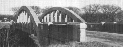
to its importance between the two cities, the section of highway past
Shady Oaks was one of the first to be paved with concrete. Shady Oaks
Cabin Camp boasted 18 cabins and a beautifully landscaped rock
garden, when almost 6,000 travelers registered in 1941 and slept
under the cool shade of the mighty oak trees. Travelers were glad to
stay in modern accommodations rather than in primitive tents or hot
hotels lacking cool ventilation.
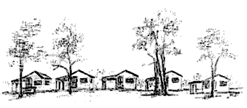
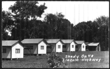
The Original 5 Cabins During the Lincoln Highway Era
(Click on the text to see actual photos)
The cabins and the other buildings at the camp were built with utility in mind. Their simple, yet attractive style is reminiscent to the era in which they were built. Though the cabins and buildings were constructed in no particular style and most were individual in character, the work of the Norton brothers is an example of practicality, ingenuity, sturdiness, and inventiveness in the early efforts to support travelers. The cabin camp was the predecessor to the motel that is so now so common.
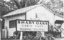
The Original 5 Cabins as seen from the Lincoln Highway
(Click on the text to see an actual photo)
Even today, while sitting under the big trees, it is easy to imagine the enlightening conversations at the cabin camp in the evening. Motorists, who had been to California, told of the wide-open stretches of the west, where they encountered little traffic enabling them to drive at any speed their car could manage. Others gave praise for the accommodations offered at Shady Oaks, and they passed the word along.
To the Marshalltown community today, Shady Oaks is synonymous with the old Lincoln Highway/U.S. 30, family reunions (where relatives sometimes stayed while visiting), picnics, Sunday drives into the country, church and social meetings, ice skating, and pitching horseshoes. Natives to the Marshalltown area have always regarded the peaceful setting of Shady Oaks as a park for community use. People return every year to recall fond memories of their childhood and family.
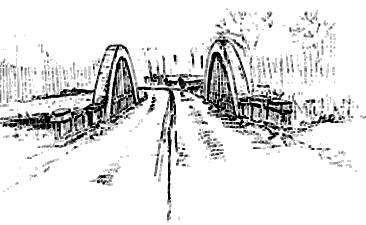
A Monument at The Big Treehouse to the Rainbow Arch Brindge
(Click on the text to see actual photos)
![]() Back to the Quarter Mile Link
Menu
Back to the Quarter Mile Link
Menu